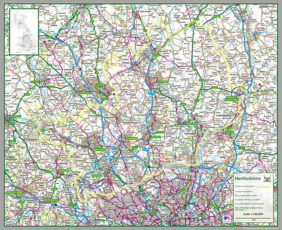


Hertfordshire County Map
Tax included.
1:100,000 detailed map of Hertfordshire, a county in England, UK.
This map covers the city of St Albans and
- Hemel Hempstead
- Stevenage
- Watford
- Welwyn Garden City
- Cheshunt
and the districts
- North Hertfordshire
- Stevenage
- East Hertfordshire
- Dacorum
- City of St Albans
- Welwyn Hatfield
- Broxbourne
- Three Rivers
- Watford
- Hertsmere
82 cm x 67cm paper laminated map
The map features the county boundary, roads, railways, land features, water features and tourist information.