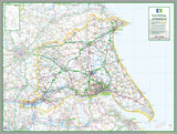
East Riding Of Yorkshire County Map
Tax included.
This 1:100,000 detailed map of East Riding Of Yorkshire, an area in the North of England, UK.
This map covers the towns:
- Kingston upon Hull
- Cottingham
- Willerby
- Bridlington
- Flamborough
- Hornsea
- Withernsea
- Aldbrough
- Hedon
- Roos
- Rudston
- Beverley
- Bishop Burton
- Driffield
- Lockington
- Goole
- Brough
- North Ferriby
- Hessle
- Kirk Ella
- Stamford Bridge
- Pocklington
- Market Weighton
- Holme-on-Spalding-Moor
- Howden
- South Cave
and the Districts of:
- East Riding of Yorkshire
- City of Kingston upon Hull
83 x 110 cm paper laminated map
The map features the county boundary, roads, railways, land features, water features and tourist information.


